The modern way of doing manual as-builts
Reliable as-built drawings are an essential foundation for successful facility management, planning or construction work. DistToPlan is a professional tool for efficient as-built measurement and data recording within buildings (factual data, inventory).
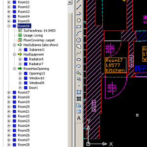
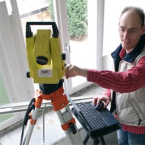
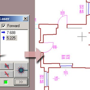
- Distances, measured by a Bluetooth hand-held laser will immediately be transformed into true to scale CAD graphics: rooms, doors, windows, etc. are being generated directly on-site with the desired degree of detail.
- In order to avoid too many or too few measurements, the AutoCAD/AutoCAD LT based DistToPlan supports indirect measuring methods and constructions.
- An intelligent structural view allows for organization of the area according to standards and the acquisition of alphanumeric attributes in data base quality.
The idea behind DisToPlan is, to avoid the need for multiple inspections of the building. The continuous, paperless data flow not only reduces the time it takes to get the documents ready, but also the consistency and plausibility of the geometry and alphanumeric data.
Advantages:
- no site revisits necessary
- Elimination of measurement errors by drawing the CAD plan on-site
- Job completed by one person versus two or more