High Accuracy
High-precision GNSS and rugged IMU sensors provide operators with precise bucket tip position.
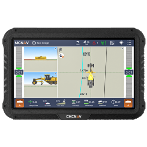
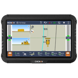
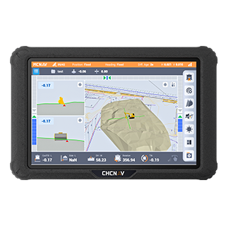
Advanced Visualization
3D view with advanced CAD engine for project files and drawings.
Wide Compatibility
Integrate with a wide range of attachments including Engcon and Steelwrist tiltrotators.
Productivity and Cost Efficiency
The system reduces manual measurements and adjustments, speeding the excavation process and optimizing workflow. The TX73 minimizes the need for rework and adjustments, resulting in shorter project schedules and maximized machine uptime.
Improved Accuracy and Precision
The TX73’s high-precision GNSS positioning uses full GNSS constellations and advanced IMU sensors to provide real-time data, reduce human error and over-excavation, and maintain the correct alignment, depth, and slope essential for high-quality results.
Enhanced Safety
Safety is improved by making as-built drawings visible to machine operators, who can anticipate potential hazards such as underground utilities. Automated guidance minimizes worker exposure to hazardous environments and reduces the likelihood of accidents.
Robust and Durable Hardware
The system is designed with durable components, including the MC300 receiver, an IP69K-rated IMU sensor, dual IP68 GNSS antennas, and a quick-release mechanism for easy tablet removal, to ensure durability in harsh environments.
Real-Time Updates and Support
Over-the-air (OTA) updates keep the system up-to-date with the latest features and enhancements, while the MCSite cloud platform enables remote troubleshooting and data synchronization, ensuring minimal downtime and maximum operational efficiency.