PRECISION AND ADVANCED SCANNING CAPABILITIES
The AlphaAir 10’s (or AA10) high-precision navigation algorithm, in conjunction with the CHCNAV scanner, provides 5 mm repeated range accuracy and achieves exceptional absolute precision in the 2 to 5 cm range, even in complex environments. With the capability of long-range measurements up to 800 m, rapid scanning at 500,000 points per second, and a continuously rotating mirror that enables scanning speeds of 250 scans per second, the AA10 enhances the detail of aerial mapping operations.
SEAMLESS DATA FUSION AND REAL-TIME DATA VIEW
The AA10 accelerates the creation of mesh models by generating high-quality point clouds. Powered by a 45 MP orthographic internal camera, the system provides high-resolution image mapping textures for efficient 3D model reconstruction with realistic point cloud colorization. In addition, the AA10 supports automated reality capture and real-time data visualization accessible directly from the UAV controller, enabling informed decision-making throughout the survey operation. Complementing the solution, CoPre and CoProcess software suite streamline post-processing and feature extraction with an easy-to-use and efficient data workflow.
ENHANCED VEGETATION PENETRATION
Leveraging advanced multi-target capabilities, the AA10 features up to 8 target echoes, enhancing its ability to penetrate dense vegetation. This feature allows the system to effectively acquire ground surfaces, resulting in accurate Digital Elevation Models (DEMs) and Digital Surface Models (DSMs), even in challenging environments with dense vegetation.
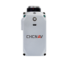
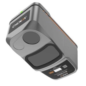
EFFICIENT DESIGN AND ROBUSTNESS
The AA10 LiDAR system is impressively lightweight and compact, weighing just 1.55 kg, and provides a 30-minute operating time when integrated with drones such as the DJI M350. The installation process is simplified with AlphaPort’s convenient one-click connection to the UAV’s power source. The AA10 is also IP64-rated to ensure the system’s resilience, allowing it to deliver consistent, reliable performance in varying operating conditions.
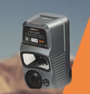
OVERVIEW
The AlphaAir 10 (or AA10) is an advanced aerial surveying solution that seamlessly integrates LiDAR and RGB sensors to meet the needs of professional UAV LiDAR mapping and drone photogrammetry.
Leveraging CHCNAV’s cutting-edge LiDAR technology, the AA10 flawlessly integrates high-precision LiDAR, accurate GNSS positioning, IMU orientation, and an industrial-grade full-frame orthophoto camera. Combined with CHCNAV point cloud and image fusion modeling software, the AA10 provides a survey-grade, efficient, and cost-effective approach to 3D data acquisition and processing.
The AA10 Airborne LiDAR + RGB System accelerates accurate 3D data collection within a single mission and simplifies the process of capturing 3D reality through a streamlined workflow.