BRING ACCURACY AT YOUR FINGERTIPS
Get the most out of GNSS RTK networks
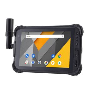
Featuring a high performance 1408 channel GPS, GLONASS, Galileo and BeiDou module and a superior tracking GNSS helix antenna, the LT800H RTK Android tablet delivers best-in-class centimeter to decimeter positioning accuracy in the most challenging environments. Its built-in 4G modem ensures seamless connectivity to GNSS RTK network corrections.
HIGH PORTABILITY AND VERSATILE
GMS certified for extended compatibility
The LT800H’s Google Mobile Service (GMS) and Android Enterprise Recommended (AER) certifications assure software compatibility and optimal performance. The tablet is designed to work seamlessly with the most popular enterprise data collection applications available from the Google Play Store. The LT800H’s certification ensures the highest levels of security and usability, making it ideal for easy integration into existing IT ecosystems.
HIGH PERFORMANCE IN ALL ASPECTS
Make data collection seamless
Powered by a 2.0 GHz octa-core processor, the LT800H RTK Android tablet displays large maps and data sets without lagging or slowing down. The 8.1-inch Corning Gorilla Glass 3 direct sunlight viewable capacitive IPS touchscreen provides durability and allows data capture with a stylus, gloves or wet hands for all working conditions. Its dual SIM 4G modem provides fast, reliable connectivity between teams in the field.
KEEP YOUR DATA SECURE
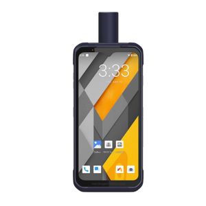
Industrial IP67 design and 9000mAh Li-ion battery
The LT800H Android RTK tablet is designed to withstand harsh environments and adverse weather conditions, ensuring that data is always safe wherever it is collected. The LT800H also offers an impressive 8 hours of battery life, allowing mobile crews to focus on collecting data without interruption. Extended battery life means less downtime and more productive time in the field.
OVERVIEW
The LT800H RTK Android tablet is the optimal solution for an efficient and productive mobile field workforce. With centimeter-to-decimeter positioning accuracy, this rugged and versatile handheld tablet is perfect for precision GIS data collection, forensic mapping, construction site layout, environmental studies, or landscaping.
Its sunlight-readable 8.1″ display enables clear viewing of GIS data tables, complex vector and raster maps, and high-resolution images, even in bright sunlight. Its IP67-rated industrial design allows it to withstand daily use in harsh environments and conditions, making it the preferred choice for field teams with demanding requirements. The LT800H brings precision GNSS positioning technology to any organization that needs to collect accurate, reliable data in the field, whether with a single operator or a large field crew.