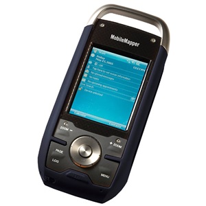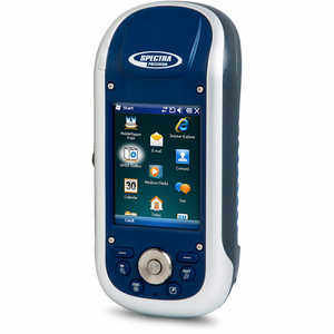
The MobileMapper® 120 is the newest generation of handheld mapping devices from Spectra Precision. Designed for GIS data collection and mapping, the MobileMapper 120 integrates an open operating system, built-in communications and Ashtech’s powerful Z-Blade technology. Z-Blade allows the MobileMapper 120 to operate in extreme GNSS environments while maintaining the high accuracies desired by GIS professionals.
The MobileMapper 120 delivers state-of-the-art features in a smart, compact, and lightweight handheld, giving users the ultimate field experience. Combined with MobileMapper Field proprietary software or our Business partners’ offerings, MobileMapper 120 brings the openness, flexibility and scalability needed to answer any mobile GIS requirements.
HIGH-ACCURACY HANDHELD
- True handheld operation
- Powerful Z-Blade processing technology
- Sub-meter or decimeter real time accuracy
- Extended position availability in urban canyons and under canopy
DESIGNED FOR THE FIELD
- Compact & lightweight design for optimal mobility, use and comfort
- Integrated communications for easy data transfer and differential GNSS
- Powerful electronics for fast data collection and seamless processing
- Ruggedized for outdoor use in extreme conditions
FLEXIBLE
- Extended connectivity and multimedia features
- Windows Embedded Handheld for full 3rd party software compatibility
- Ancillary sensor interfacing
- GNSS scalability: GPS or GPS/GLONASS configurations
- Compatible with 3rd party networks (VRS, FKP, MAC)
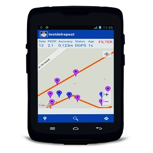
MOBILEMAPPER FIELD AND OFFICE SOFTWARE
COMPLETE SOLUTION:
The MobileMapper software suite includes all GIS features that professionals really need without the burden of complicated and rarely used functions. It also provides a direct interface to external sensors such as laser range-finders.
VERSATILE APPLICATION:
MobileMapper Field is the perfect solution for GIS data collection, asset management, area measurements, map creation and update.
EASY TO LEARN, EASY TO USE:
Spectra Precision software is very intuitive, requiring a minimum of user training. It enables rapid deployment across the workforce for large scale GIS data collection or maintenance.