Information
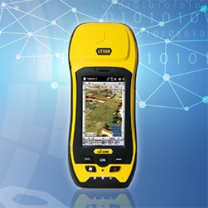
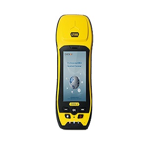
Extremely affordable, LT30 is a the ideal rugged field computer for a large range of applications from GIS data collection and maintenance, agriculture field measurement, environmental control…
Features
⇒ Rugged professional GPS/GIS Data Controller
⇒ Windows Mobile 6.1 operation system
⇒ 3.7″ VGA sunlight readable screen
⇒ High-sensitivity GPS for outstanding performances
⇒ Built-in GPRS phone and data transmission
⇒ Bluetooth and Wi-Fi connectivity
⇒ 3.2 megapixel camera with autofocus
Technical Parameters
GNSS characteristics
⇒ High-sensitivity SiRF III chipset
⇒ 20-channel GPS L1, including 2?SBAS
⇒ Update Rate: 1Hz
⇒ Time to first fix
– Cold Start < 50 s
– Warm start < 35 s
– Hot Start <1 s
⇒ External Antenna support
Performance specifications (1)
⇒ Stand alone GPS : < 3 m RMS
⇒ With SBAS : < 2 m RMS
System configuration
⇒ Windows Mobile 6.1 operating systems
⇒ 3.7″ VGA sunlight readable screen
⇒ 624 MHz processor
⇒ Internal memory : 256 MB internal flash storage
⇒ Micro SD card slot up to 16 Gb
⇒ 3.2 megapixel camera with autofocus
Communications
⇒ GSM/GPRS (850/900/1800/1900 Mhz) phone and data transmission
⇒ Bluetooth V2.0
⇒ Wi-Fi 802.11 b/g
⇒ Mini-USB client
⇒ Built-in microphone and speaker
⇒ NMEA 0183 protocol support
Physical
⇒ Size (LxWxH): 158 mm x 85 mm x 25mm
⇒ Weight: 0.340 Kg with battery
⇒ Working Temperature: -20 C to +60 C
⇒ Storage Temperature: -30 C to +70 C
⇒ Dust proof: IP65
⇒ Shock : survive a 1 meters drop onto concrete
Electrical
⇒ Li-ion battery capacity : 3000 mAh
⇒ Battery life : up to 10 hours
(1) Accuracy, TTFF and reliability specifications may be affected by multi path, satellite geometry and atmospheric conditions. Performances assume minimum of 5 satellites and follow up of recommended Survey practices – Specifications are subject to change without notice.


