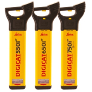
| The Leica Digicat xf-Series locators are designed with an emphasis on long distance tracing and the detection of sewer – camera inspection systems. Two additional tracing frequencies, 512Hz and 640Hz, have been added to the xf-Series locators and signal transmitters, delivering a greater tracing range for ground surveyors and utility contractors.Additional features such as Mode Lock, where the locator starts in the last mode of use and Current Measurement, used to identify utilities and potential faults, will provide operators with an effective solution for their surveying task.
GIS mapping via Bluetooth® connectivity allows operators to seamlessly capture information about the utility they are surveying. The geographical position and utility depth can be captured, additional site notes and photographs can also be included, maximizing the survey process. |
Leica Digicat xf-Series
|
Features |
Digicat 500i xf | Digicat 550i xf | Digicat 600i xf | Digicat 650i xf | Digicat 750i xf |
| Frequency / Mode | Power mode 50 Hz or 60 Hz, Radio mode 15 kHz to 60 kHz, Transmitter mode 8 kHz, 33 kHz, 512 Hz and 640 Hz, Auto mode = Power + Radio mode | ||||
| Depth detection (typical) | Power to 3m, Radio to 2m Transmitter mode – Dependant on transmitter or Sonde type |
||||
| Batteries | 6 x AA alkaline (IECLR6), supplied | ||||
| Battery life | 40 hours intermittent use (at 20°C) | ||||
| Weight | 2.7kg including batteries | ||||
| Depth estimation | Not available | Line mode – 0.3 to 3m Sonde mode – 0.3 to 9.99m 10% of depth in line or Sonde
|
Not available | Line mode – 0.3 to 3m Sonde mode – 0.3 to 9.99m 10% of depth in line or Sonde |
Line mode – 0.3 to 3m Sonde mode – 0.3 to 9.99m 10% of depth in line or Sonde |
| Protection | Conforms to IP54 | ||||
| Bluetooth® | Not available | Not available | Enabled | Enabled | Enabled |
| Compatibility | Not available | Not available | CSV file compatibility program | ||
| Memory size | Not available | Not available | 32MB memory | 32MB memory | 64MB memory |
| GIS mapping capability | X | X | X | ||
| Integrated GPS technology | X | ||||
| GPS type* | Chipset: u-blox®GPS, Technical Data; Type: L1 frequency, C/A code | ||||
| GPS accuracy** | Position 2.5 m CEP, SBAS 2.0 m CEP | ||||
| GPS start time | Cold 34s typical, Warm 34s typical, Hot 1s typical | ||||
* All data/information according to Manufacturer u-blox®GPS; Leica Geosystems does not assume any liability whatsoever for such information.
** Accuracy is dependent upon various factors including atmospheric conditions, multipath, obstructions, signal geometry and number of tracked satellites.


