Use Carlson Geology to manage drillhole data, plus calculate strata models, block models, quantities and qualities. The process from importing drillholes, validating the data and modeling the ore to reserve calculations is seamless.
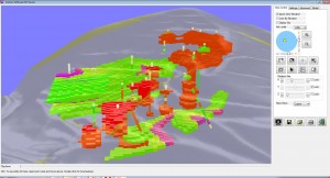
Block Model Viewer for Geology
For drillholes, Carlson Geology enables users to:
- Produce accurate models
- Automate data
- Turn out reports quickly & easily
- Differentiate by quality & tonnage
- Analyze for compliance
Utilize correlated and validated drillhole data to generate isopach maps complete with custom colors and naming. Supports all the major geological modeling techniques, including triangulation, inverse distance, Kriging, polynomial and least squares. Calculate the reserves for each pit and bench instantly with the 3D Surface History and play it back in real time with 3D mine simulations.
Legendary ease-of-use combined with powerful features
The Carlson Geology Module uses drillhole and sample data to create accurate and easy-to-use subsurface geologic models.
- Import any drillhole format and store data in CAD or external database such as SQLite
- Utilize fast macros to reproduce the model with new drilling samples and surveys
- Fault automatically at any dip-angle and displacement to offset the geology
- Create geologic cross-sections and fence diagrams instantly from polylines, picking points or saved alignments
- Generate mine reserves and reserve classification for Measured, Indicated and Inferred analysis with flexible reporting directly into Excel
Drillholes
- Import from any format using custom settings, storing in CAD or linked to SQLite database
- Draw geologic columns in section or in 3D for correlation and checking
- Validate holes with queries and reports to highlight data errors
- Use tools such as Ferm and Horizon Codes combined with Drillhole equations for high level model building
Modeling
- Use industry standard geological modeling algorithms and calculate residuals to see which method is recommended
- Create macros and utilities to reproduce the model with new data
- Check the models with inspector tools and color hatched isopachs
- Enhance the model with limit lines, strata polylines, pit and channel samples combined with the drilling
- Add grids or TINs to the Pre-calculated model for reserves and sections
Cross-Sections & Fence Diagrams
- Instantly view sections from polylines or realtime with dynamic section line movement.
- Hatch sections by attributes and grade with drillholes posted for model correlation
- Stack up sections in 2D, or place in 3D for visualization with mine designs and topo
- Create the initial sections for dragline range diagrams using the real geology and surfaces
Faults
- Place fault lines at the topography with variable dip-angles and displacements to create normal or strike-slip faults
- Draw the fault plane for viewing in 3D
- Have the program find the displacement shift by analyzing the surrounding drillholes
- Apply faults to existing model with new data
Mine Reserves
- Use the Pre-calculated model for reserves with weight averaged quality attributes
- Create strip ratio grids to determine mineable reserves regions
- Format the reports with equations and attribute options while exporting directly into Excel
- Analyze deposits with Reserve Classification to report and hatch the measured, indicated, inferred and hypothetical results
- Fine tune the reserves with automatic options such as minimum thickness of ore and waste, dilution above and below, recovery, density and weathered depth
- Breakout the reserves by vertical quantities, overall highwall slopes, or detailed bench by bench designs and surface history files