Simple, yet powerful data post-processing with Carlson SurveyGNSS
Carlson SurveyGNSS is now released!
SurveyGNSS post-processing software is a reliable and precise tool for all post-processing applications and is tightly integrated into the Carlson field and office workflow. Carlson SurveyGNSS allows users to:
- Achieve high accuracy results in areas with limited or no real-time corrections
- Import GNSS observations from any GNSS receiver in RINEX format
- Accept GNSS observations in a variety of proprietary formats
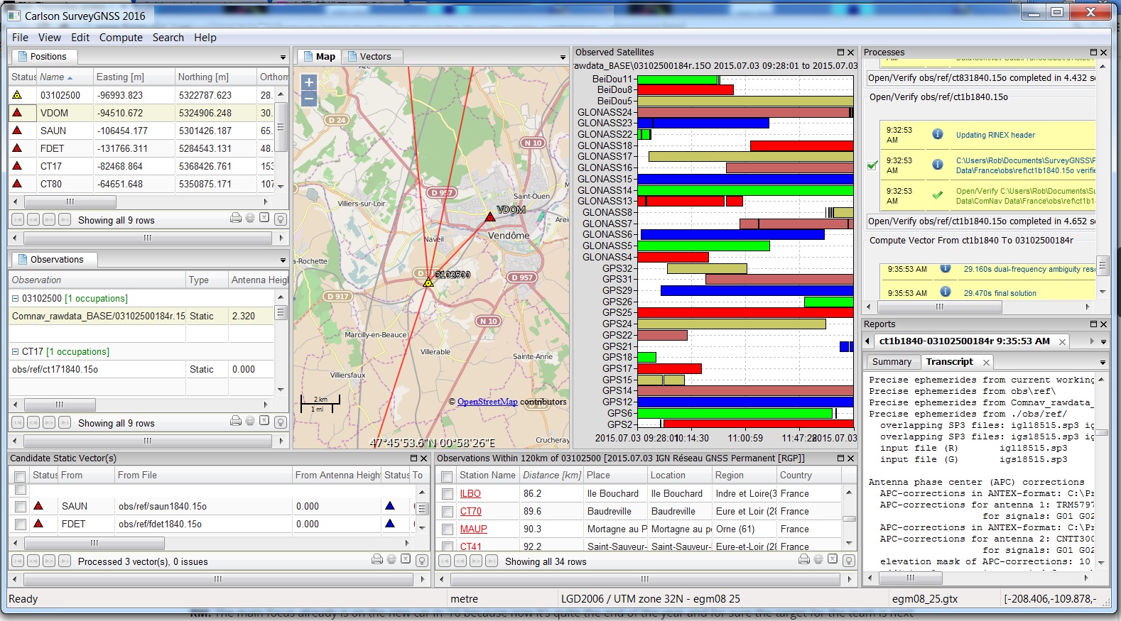 Get intuitive user interface with tables, maps and graphs
- Improve the quality of single frequency GIS data
- Interact efficiently with Carlson SurvCE, SurvPC and Carlson office software
- Do quality control of GNSS data before export to Survey or GIS software
In keeping with the Carlson hallmark of interoperability with the greatest amount of GNSS hardware, SurveyGNSS is designed to accept GNSS data from any receiver in RINEX format. Furthermore, it will also accept proprietary GNSS data in an increasing number of manufacturer formats including NovAtel, Hemisphere GNSS, Altus/Septentrio, and Javad. Additional manufacturer formats will be added in concert with manufacturer cooperation and customer demand.
Carlson SurveyGNSS is developed in partnership with WaSoft of Dresden, Germany, and its proven line of GNSS software technologies